AgMaps in Action
Mapping & Scouting with AgMaps
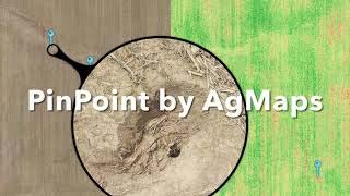
Learn how to quickly map and scout fields with AgMaps PinPoint. Simply define the field boundary and let AgMaps create imagery for you in as little as 10 minutes. Drop pins on field variability issues and AgMaps will send the drone out to capture high-resolution close-up photos. When the drone is done, you're done.

PinPoint Scouting with AgMaps
Use AgMaps's new PinPoint scouting feature to capture high resolution close-ups of your crops. Locate field variability issues in your field and send the drone out to scout.
Great Maps with AgMaps
AgMaps handles flight planning, preflight checklist, drone flight, and imagery creation, allowing you to make great maps every time. When you're done, walk out to the field for manual inspection or easily export the map so your clients can see.
